Episode 06 · Route satellite · MAP-E06-CURRENT-001

Hades in present-day Dublin

Ten literary waypoints, translated into current names without pretending that Joyce supplied a modern itinerary.

Why keep this separate? The episode’s route is a reading reconstruction. Current streets, access, transport, and cemetery practice belong to a dated orientation layer that can be corrected without rewriting the literary sequence.

Current-information boundary

Useful for bearings, not for navigation

Research and reading orientation only. Street layouts, access, traffic, works, opening hours, and cemetery rules can change; check current official information before travel.

This project has not audited present-day step-free routes, crossings, surfaces, gradients, toilets, or transport accessibility.

Geometry: Ten ordered literary control points joined by straight segments; not a surveyed road trace and not turn-by-turn navigation.

01 · Current orientation

The same order, under current names

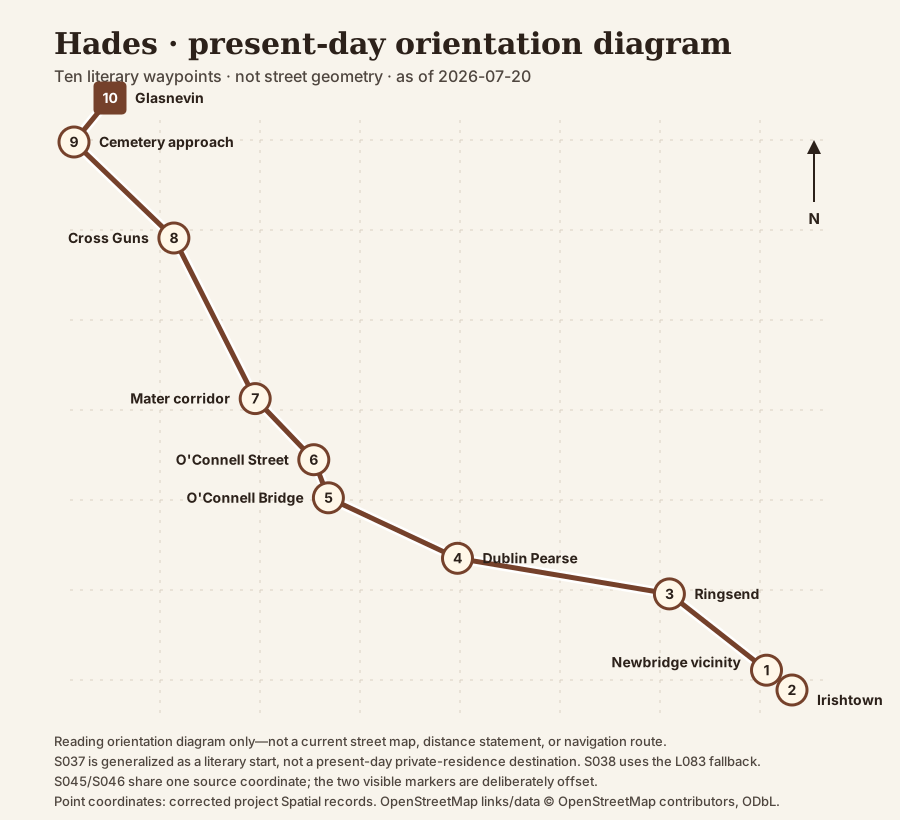
Ten numbered current-orientation waypoints from a generalized Newbridge Avenue start to Glasnevin; stops nine and ten are visually separated even though they share one source coordinate.
Project-generated orientation diagram, not a current street map. Point positions come from the corrected Spatial release; straight connectors preserve literary order rather than road geometry. S037 is presented as a generalized literary start rather than a present-day private residence. S038 uses the L083 fallback. S045 and S046 share one source coordinate and are offset only in the drawing. Open the full-size SVG diagram.

02 · Name and place crosswalk

Ten stops, with the change made visible

Current labels do not replace 1904 names. Both travel with the same stable stop and location IDs so a correction can remain bounded.

  1. 1. Newbridge Avenue vicinity

    Then: outside fictional Dignam residence, No. 9 Newbridge Avenue

    Reading action: Bloom joins Cunningham, Power, and Simon Dedalus in the cramped carriage behind Dignam's hearse.

    Limit: No. 9 is a plausible fictional address. The public current-route layer generalizes the coordinate and does not identify a present-day private house.

    Privacy: The current layer generalizes this fictional literary start and does not identify or invite visits to a present-day private residence.

  2. 2. Newbridge Avenue, Tritonville Road, Irishtown Road and Dermot O'Hurley Avenue

    Then: Newbridge Avenue, Tritonville Road, Irishtown Road past Watery Lane

    Reading action: Bloom points Stephen out; Simon stretches across, but the turning carriage prevents father and son from meeting.

    Limit: Stephen is seen at a distance, not a carriage participant.

  3. 3. Ringsend Road/Pearse Street approaches and Grand Canal crossing

    Then: Ringsend Road past Wallace Bros bottleworks, Dodder bridge and Grand Canal bridge

    Reading action: The carriage passes the bottleworks and waterways, pausing at the Grand Canal bridge.

    Limit: Street order is firmer than the exact minute or an individual bridge pin.

  4. 4. Pearse Street past Dublin Pearse station

    Then: Great Brunswick Street past Westland Row station, Antient Concert Rooms, St Mark's and Queen's Theatre

    Reading action: Travelling west, the mourners pass the station and a dense series of theatrical, religious, and commercial landmarks.

    Limit: This correction is release-layer-only pending a separately governed canonical spatial refresh.

    See the current photograph associated with stop 4

  5. 5. D'Olier Street and O'Connell Bridge

    Then: D'Olier Street/Red Bank restaurant, Crampton memorial and O'Connell Bridge

    Reading action: The men salute Boylan outside the Red Bank; Bloom withdraws under their attention, and the cortege crosses the Liffey.

    Limit: Boylan is seen from the moving carriage, not a funeral-party participant.

    See the current photograph associated with stop 5

  6. 6. O'Connell Street Lower; Nelson's Pillar site now occupied by the Spire

    Then: Lower Sackville Street past O'Connell statue, Sir John Gray statue, Nelson's Pillar and west-side institutions

    Reading action: The cortege passes major nationalist and imperial monuments while the men tell stories of death, rescue, and debt.

    Limit: Reuben J. Dodd is seen in the street and then discussed; he is not a carriage participant.

  7. 7. Parnell Square, Blessington Street, Berkeley Road and Mater Hospital

    Then: Rutland Square hill, Blessington Street and Berkeley Road past the Mater Hospital and Eccles Street

    Reading action: As the men discuss suicide, Bloom passes the Mater and steals a look down Eccles Street toward home.

    Limit: Do not transfer the known demolition status of No. 7 Eccles Street to the whole multi-street corridor.

    See the current photograph associated with stop 7

  8. 8. Phibsborough Road, Cross Guns Bridge and Prospect Road/Finglas Road approach

    Then: Dunphy's corner, Phibsborough Road, Cross Guns Bridge over the Royal Canal, then left into Finglas Road

    Reading action: Cattle delay the cortege; it crosses the Royal Canal and turns toward the cemetery.

    Limit: Sequence is firm; the minute remains broad.

    See the current photograph associated with stop 8

  9. 9. Prospect Road/Glasnevin Cemetery approach

    Then: Finglas Road past Dennany's stonecutter's yard, Bengal Terrace and Prospect Cemetery railings

    Reading action: Memorial sculpture appears commercially before the carriage stops and the men descend.

    Limit: This stop shares a stored coordinate with S046; separate the markers visually without implying separate surveyed points.

  10. 10. Glasnevin Cemetery

    Then: Prospect Cemetery mortuary chapel, Dignam grave and cemetery paths including Parnell's grave

    Reading action: The service proceeds from chapel to grave; Bloom observes the burial and passes political and personal graves.

    Limit: This stop shares a stored coordinate with S045; separate the markers visually without implying separate surveyed points.

    See the current photograph associated with stop 10

Open the full four-column route table—horizontal scrolling required on narrow screens
Ordered current-name crosswalk for the Hades literary route
StopPresent-day orientation1904 / literary orientationEvidence and caution
1S037 · L138Newbridge Avenue vicinitySandymount, Dublin 4; generalized public orientation, not a property pinGeneralized literary start; no per-stop present-day map link is provided.outside fictional Dignam residence, No. 9 Newbridge AvenueBloom joins Cunningham, Power, and Simon Dedalus in the cramped carriage behind Dignam's hearse.RECON53.336, -6.223privacy-generalized vicinity from corrected route stop; exact property pin withheldNo. 9 is a plausible fictional address. The public current-route layer generalizes the coordinate and does not identify a present-day private house.Privacy: generalized literary start; not a present-day private-residence destination.
2S038 · L083Newbridge Avenue, Tritonville Road, Irishtown Road and Dermot O'Hurley AvenueSandymount/Irishtown, Dublin 4Open this stop on the current map: stop 2, Newbridge Avenue, Tritonville Road, Irishtown Road and Dermot O'Hurley AvenueNewbridge Avenue, Tritonville Road, Irishtown Road past Watery LaneBloom points Stephen out; Simon stretches across, but the turning carriage prevents father and son from meeting.RECON53.3347, -6.2209location-fallback; route-stop coordinate is nullStephen is seen at a distance, not a carriage participant.
3S039 · L097Ringsend Road/Pearse Street approaches and Grand Canal crossingRingsend, Dublin 4 to Dublin 2Open this stop on the current map: stop 3, Ringsend Road/Pearse Street approaches and Grand Canal crossingRingsend Road past Wallace Bros bottleworks, Dodder bridge and Grand Canal bridgeThe carriage passes the bottleworks and waterways, pausing at the Grand Canal bridge.RECON53.341, -6.231route-stopStreet order is firmer than the exact minute or an individual bridge pin.
4S040 · L051Pearse Street past Dublin Pearse stationPearse Street/Westland Row, Dublin 2Open this stop on the current map: stop 4, Pearse Street past Dublin Pearse stationSee photograph for stop 4Great Brunswick Street past Westland Row station, Antient Concert Rooms, St Mark's and Queen's TheatreTravelling west, the mourners pass the station and a dense series of theatrical, religious, and commercial landmarks.RECON53.3433347, -6.2484634route-stopThis correction is release-layer-only pending a separately governed canonical spatial refresh.
5S041 · L030D'Olier Street and O'Connell BridgeDublin 2 to Dublin 1Open this stop on the current map: stop 5, D'Olier Street and O'Connell BridgeSee photograph for stop 5D'Olier Street/Red Bank restaurant, Crampton memorial and O'Connell BridgeThe men salute Boylan outside the Red Bank; Bloom withdraws under their attention, and the cortege crosses the Liffey.RECON53.3473, -6.2591route-stopBoylan is seen from the moving carriage, not a funeral-party participant.
6S042 · L067O'Connell Street Lower; Nelson's Pillar site now occupied by the SpireO'Connell Street, Dublin 1Open this stop on the current map: stop 6, O'Connell Street Lower; Nelson's Pillar site now occupied by the SpireLower Sackville Street past O'Connell statue, Sir John Gray statue, Nelson's Pillar and west-side institutionsThe cortege passes major nationalist and imperial monuments while the men tell stories of death, rescue, and debt.RECON53.3498, -6.2603route-stopReuben J. Dodd is seen in the street and then discussed; he is not a carriage participant.
7S043 · L098Parnell Square, Blessington Street, Berkeley Road and Mater HospitalDublin 1 and Dublin 7Open this stop on the current map: stop 7, Parnell Square, Blessington Street, Berkeley Road and Mater HospitalSee photograph for stop 7Rutland Square hill, Blessington Street and Berkeley Road past the Mater Hospital and Eccles StreetAs the men discuss suicide, Bloom passes the Mater and steals a look down Eccles Street toward home.RECON53.3538099, -6.2651306route-stopDo not transfer the known demolition status of No. 7 Eccles Street to the whole multi-street corridor.
8S044 · L041Phibsborough Road, Cross Guns Bridge and Prospect Road/Finglas Road approachPhibsborough, Dublin 7Open this stop on the current map: stop 8, Phibsborough Road, Cross Guns Bridge and Prospect Road/Finglas Road approachSee photograph for stop 8Dunphy's corner, Phibsborough Road, Cross Guns Bridge over the Royal Canal, then left into Finglas RoadCattle delay the cortege; it crosses the Royal Canal and turns toward the cemetery.RECON53.3643383, -6.2718271route-stopSequence is firm; the minute remains broad.
9S045 · L046Prospect Road/Glasnevin Cemetery approachGlasnevin, Dublin 11Open this stop on the current map: stop 9, Prospect Road/Glasnevin Cemetery approachFinglas Road past Dennany's stonecutter's yard, Bengal Terrace and Prospect Cemetery railingsMemorial sculpture appears commercially before the carriage stops and the men descend.RECON53.372077, -6.2785783route-stopThis stop shares a stored coordinate with S046; separate the markers visually without implying separate surveyed points.
10S046 · L095Glasnevin CemeteryFinglas Road, Glasnevin, Dublin 11Open this stop on the current map: stop 10, Glasnevin CemeterySee photograph for stop 10Prospect Cemetery mortuary chapel, Dignam grave and cemetery paths including Parnell's graveThe service proceeds from chapel to grave; Bloom observes the burial and passes political and personal graves.RECON53.372077, -6.2785783route-stopThis stop shares a stored coordinate with S045; separate the markers visually without implying separate surveyed points.

03 · Place photographs

Five bearings—not ten illustrations

The set is intentionally bounded. It orients the Pearse, central-city, Mater, Cross Guns, and Glasnevin legs without treating a present-day private house as Dignam’s fictional home or manufacturing a photograph for every stop.

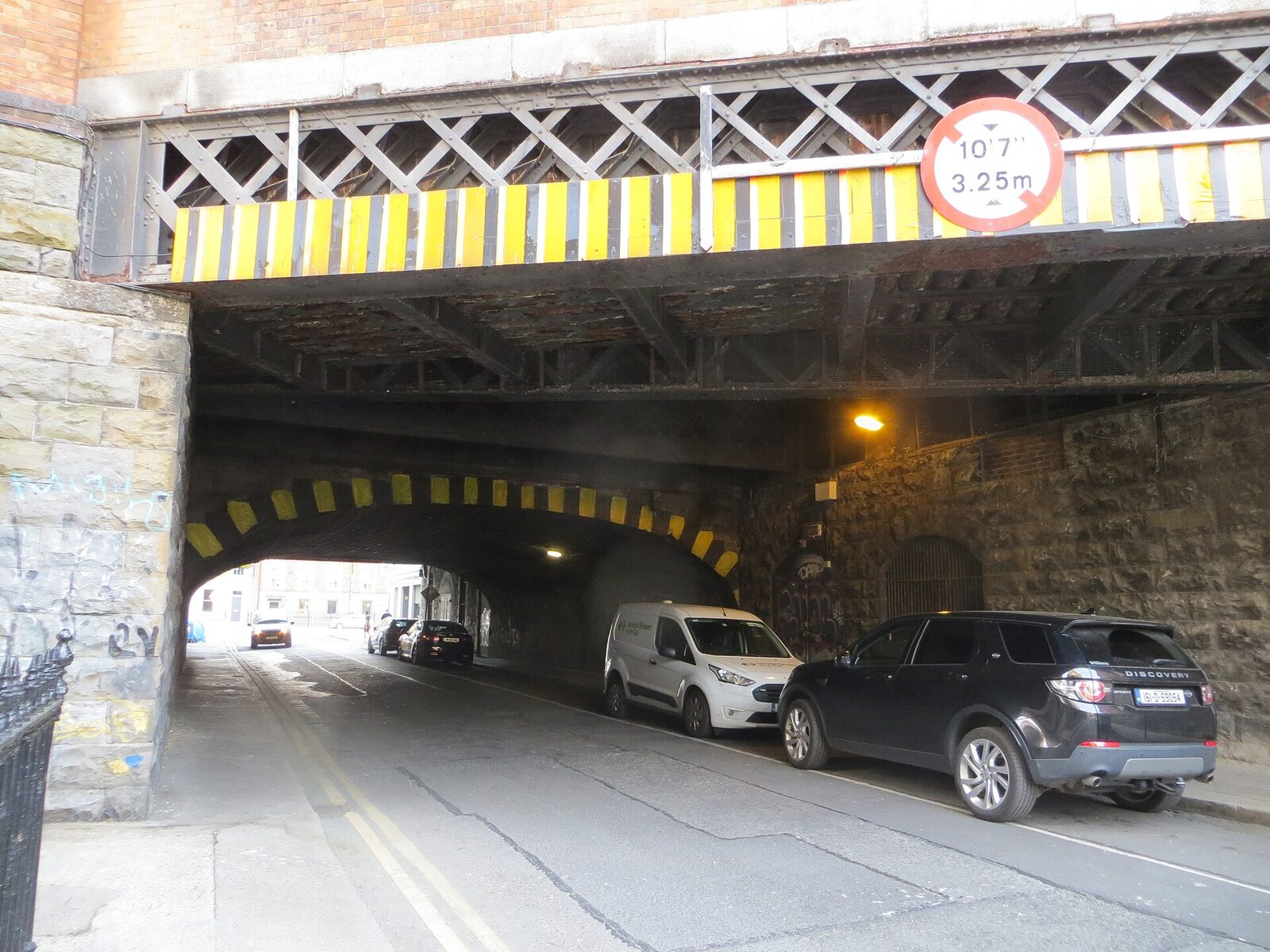
A narrow road passes beneath two stacked iron railway arches at Dublin Pearse station. Yellow-and-black height bars mark the lower arch; cars are parked under the stone and iron structure.
Route stop 4 · S040Dublin Pearse Station, Cumberland Street South low archThe surviving railway structure grounds the Westland Row/Dublin Pearse correction without claiming that the carriage occupied this precise modern viewpoint.Truth role: current orientation that makes the Westland Row to Dublin Pearse correction concrete; not the exact 1904 carriage pinDublin Pearse Station low arch, Djm-leighpark, 19 July 2022, CC BY-SA 4.0; cropped/resized.Source record for Dublin Pearse Station, Cumberland Street South low arch · Licence for Dublin Pearse Station, Cumberland Street South low arch
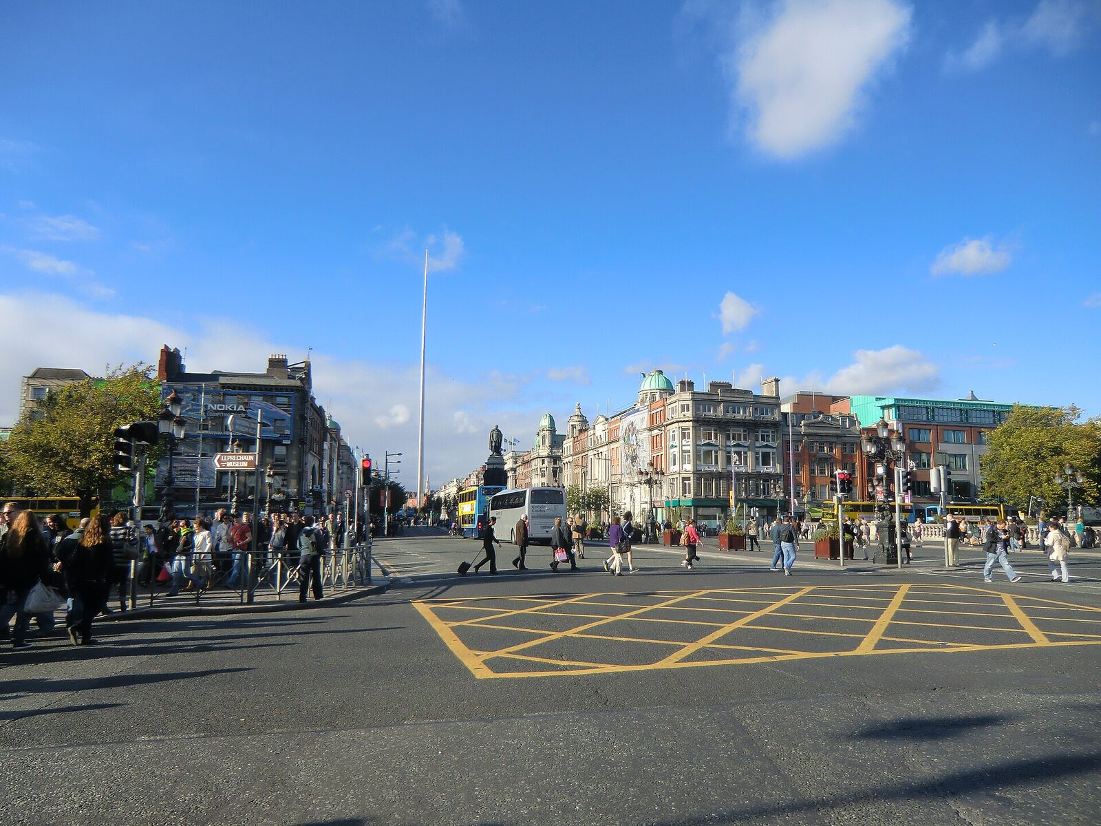
Daylight view north across the bridge’s wide roadway toward O’Connell Street. Pedestrians, buses, and traffic fill the junction; the O’Connell monument and Spire align down the centre.
Route stop 5 · S041O’Connell Bridge looking northThe present-day image confirms the crossing as a useful orientation point while making visible how monuments, traffic, and street furniture have changed.Truth role: later orientation at a surviving crossing; not evidence of 1904 traffic or viewpointO’Connell Bridge looking north, YvonneM, 14 September 2011, CC BY-SA 3.0; cropped/resized.Source record for O’Connell Bridge looking north · Licence for O’Connell Bridge looking north
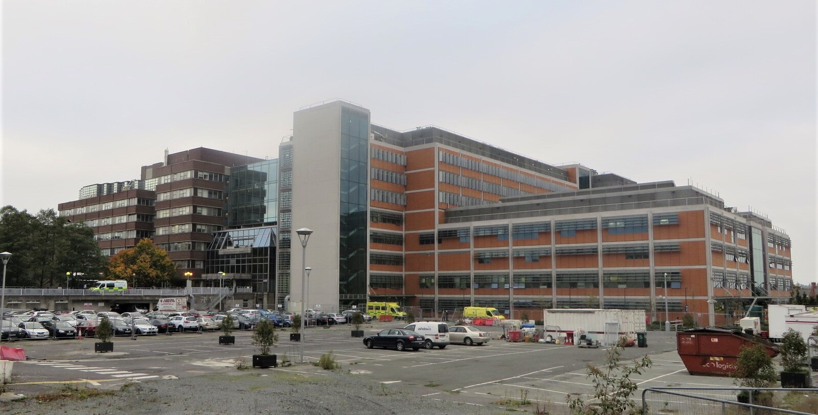
Wide view across a mostly open car park toward the Mater Hospital complex: low dark-brick blocks stand beside larger red-brick and glass buildings, with several yellow ambulances near the entrances under an overcast sky.
Route stop 7 · S043Mater Misericordiae University Hospital, DublinThe working hospital gives present-day scale to the Mater/Eccles corridor while remaining separate from the novel's glance toward home and from any claim about the exact No. 7 Eccles Street site.Truth role: current Mater/Eccles corridor orientation; not No. 7 Eccles Street, a 1904 frontage, or Bloom's viewpointMater Misericordiae University Hospital, O'Dea, 3 November 2015, CC BY-SA 4.0; resized.Source record for Mater Misericordiae University Hospital, Dublin · Licence for Mater Misericordiae University Hospital, DublinUse note: The photograph shows a working hospital exterior. Do not identify patients or staff, imply endorsement, or treat this reuse as permission for new onsite photography.
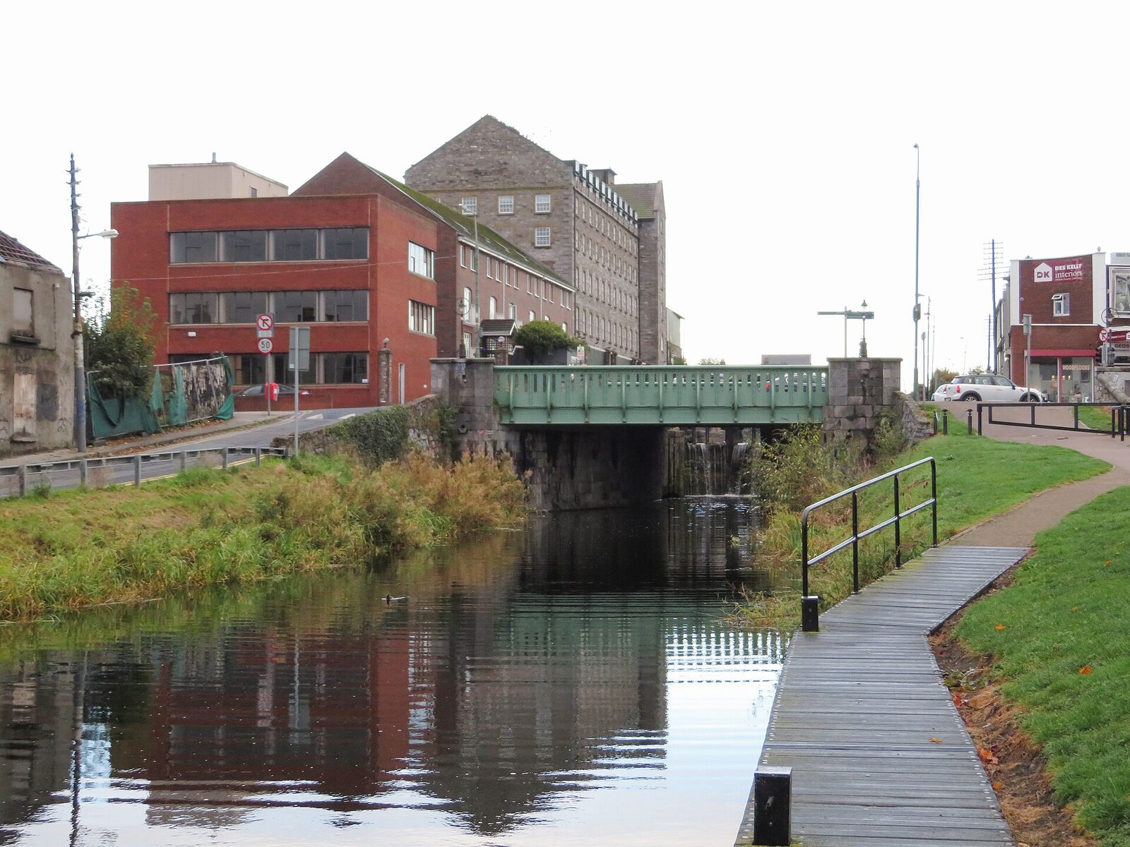
Still water of the Royal Canal fills the foreground; a narrow towpath curves beside it to a low green metal bridge, with grass and mixed industrial buildings beyond.
Route stop 8 · S044Royal Canal at Cross Guns Bridge in DublinCanal, towpath, and bridge remain practical orientation features, but the image supplies no evidence for the episode’s barge, horse, or 1904 traffic.Truth role: exact current place orientation; not proof of the 1904 turf barge or towpath horseRoyal Canal at Cross Guns Bridge in Dublin by Gareth James, 14 October 2018, CC BY-SA 2.0; cropped/resized.Source record for Royal Canal at Cross Guns Bridge in Dublin · Licence for Royal Canal at Cross Guns Bridge in Dublin
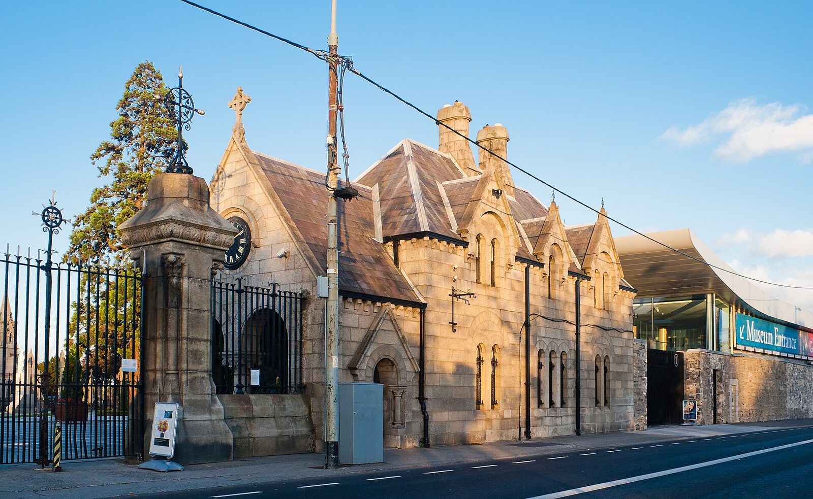
Stone Gothic cemetery entrance with clock and wrought-iron gates beside a modern glass museum entrance; the road and curb run across the foreground under a clear blue sky.
Route stop 10 · S046Glasnevin Cemetery entranceThe entrance orients a present-day visitor to Glasnevin while preserving the distinction between a public cemetery threshold and the novel’s fictional grave sequence.Truth role: current entrance orientation at an active cemetery; not Dignam’s grave or funeralGlasnevin Cemetery entrance, Andreas F. Borchert, 28 September 2012, CC BY-SA 4.0; cropped/resized.Source record for Glasnevin Cemetery entrance · Licence for Glasnevin Cemetery entranceUse note: Caption and use must respect the active cemetery and distinguish visitor orientation from fictional burial evidence.

04 · Sources, rights, limits

A dated orientation layer with an exit

Diagram and route

Corrected project Spatial coordinates and current-name crosswalk; OpenStreetMap links supply live external orientation but no tiles are embedded.

Map data from OpenStreetMap contributors. Copyright and licence.

Standard OpenStreetMap live tiles are not embedded. GeoJSON and the waypoint-only GPX retain the non-navigation flag, data vintage, fallback, and coincident-coordinate records.

Photography

Every displayed image has a retained exact hash, item source, creator/date, selected licence, required credit, alternative text, and truth role. ShareAlike applies to adapted image derivatives under each selected licence, not to unrelated prose or code.

Accessibility

The static image is supplemented by a complete HTML table and ordered prose list. Marker numbers, headings, written evidence labels, borders, and source order carry meaning without colour. There is no animation or map-only interaction.

Known limits

  • S038 is a location fallback, not a measured route-stop pin.
  • S045 and S046 are distinct narrative stops with one stored coordinate.
  • S037 is generalized as a literary start; it is not a present-day private-residence destination.
  • The Westland Row station corridor is Dublin Pearse, not Connolly.
  • The Mater/Eccles record is a corridor, not the exact No. 7 Eccles Street site.
  • The orientation diagram does not claim road geometry, distance, current safety, or step-free access.

Current public sources

  1. Dublin PearseIarnród Éireann / Irish Rail · verified 2026-07-20Current station identity and Westland Row address; supports the release-layer correction from Connolly to Dublin Pearse.
  2. Cross Guns BridgeNational Inventory of Architectural Heritage · verified 2026-07-20Current bridge identity and Royal Canal crossing orientation.
  3. Plan your visit: Glasnevin CemeteryDublin Cemeteries Trust · verified 2026-07-20Current official visitor information; recheck before any journey.
  4. Media and photographyMater Hospital · verified 2026-07-20Current privacy and onsite filming/photography policy; this project reuses an already licensed Commons image and does not direct new onsite photography.
  5. City Trail: The Parnell StatueDublin Cemeteries Trust · verified 2026-07-20Current institutional context confirming Charles Stewart Parnell's burial at Glasnevin; supports a bounded HIST contextual-presence note, not the episode's reported coffin story.

E06-HADES-PUBLIC-RELEASE-0.8 · generated view 0.8 · route vintage 2026-07-20 · private repository created · publicly deployed.